
Reality Baseline
Industrial 3D scanning:
turning a survey into
an engineering baseline
A point cloud describes visible surfaces. It does not revalidate a P&ID, does not identify a piping class and does not decide how to modify the installation. To become useful to a brownfield project, the survey has to be inspected, put in context, checked, and then linked to the documents and the technical data.
Moreau Engineering carries out the 3D scan on site, builds the as-built model and continues through to the engineering of the modification. The survey becomes a Reality Baseline: a shared reference for the existing plant, designed to prepare a revamping, to reconstitute a documentary record, and to stop every project from beginning again with the same investigations.
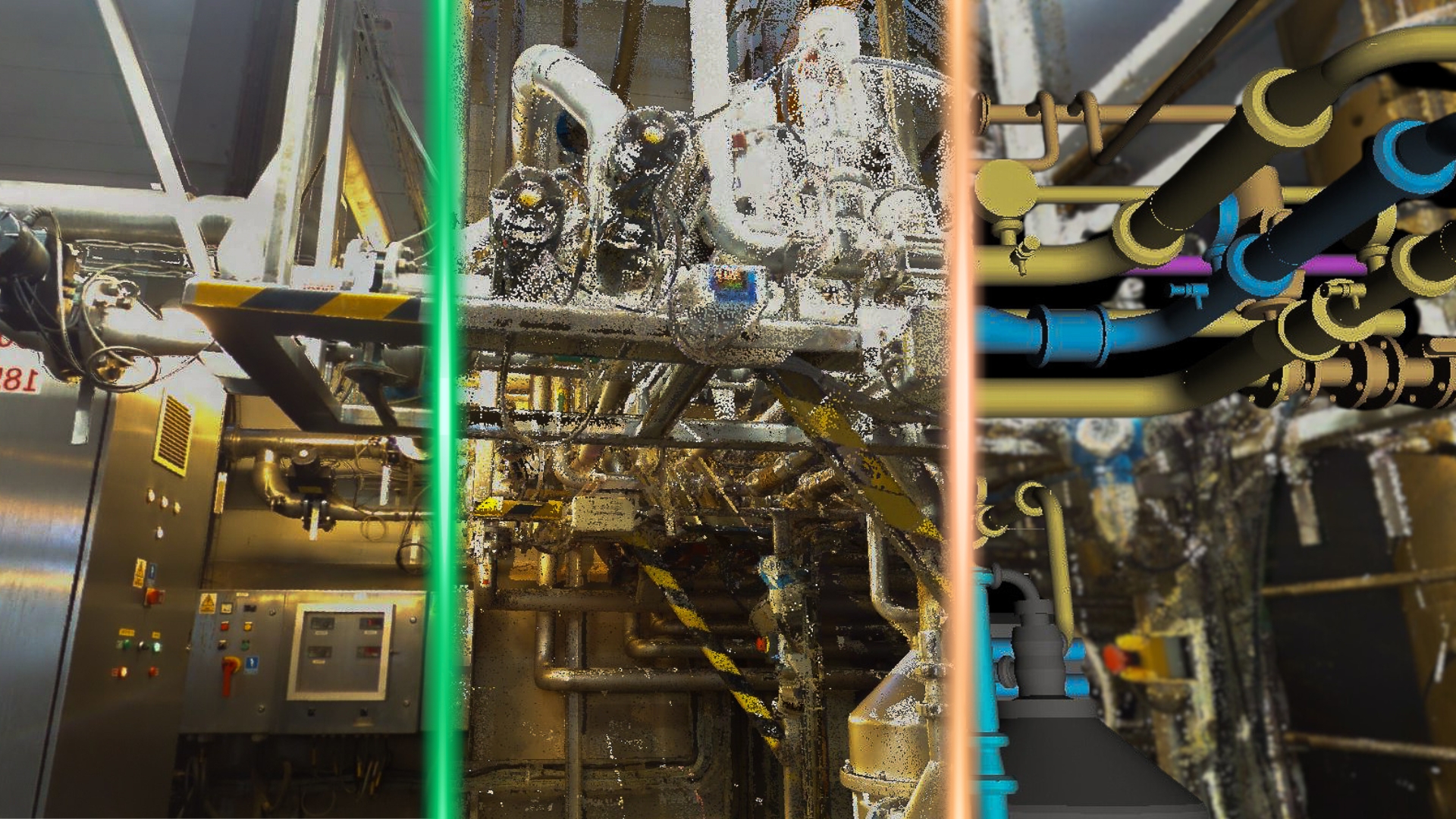
The initial need is usually geometric: locating a tie-in, checking a route, or establishing the envelope of an item of equipment. The survey generally reveals a wider problem: the installation and its documentary record have evolved at different speeds.
Our internal measurements cover eleven installations examined through repeated audit campaigns. Diameter is the only discrepancy we have met on every one of them; piping class and pressure rating follow, present on nine installations out of eleven. Among those three attributes, diameter and class concentrate close to nine discrepancies out of ten.
Reconciling diagrams with the model also reveals structural inconsistencies: valves that no longer match the diagram, mixed diameters within a single line, inconsistent piping classes at component level, line numbers assigned twice. The detail of these discrepancies, and above all their consequences for a modification study, are developed on the page devoted to existing installations.
These discrepancies do not all have the same origin or the same severity. Some come from a field change never reported. Others result from a numbering rule applied differently, from a technical transition poorly represented, or from an old value copied from one document to the next. The survey provides the starting point of the investigation; the engineering review qualifies the finding.
Across all the surveys analysed, the median share of findings classified as critical stands at one third: these have to be resolved before designing or intervening safely. That share varies considerably from one installation to another, which rules out presuming the state of a dossier before it has been measured. The survey therefore does not merely produce a faithful image: it locates the decisions that still have to be taken.
The point cloud measures what exists and what is visible. The design determines what has to be built, how it is to be connected, with which classes, which supports, which erection constraints and in what sequence.
A scanning contractor can deliver an E57 file or a geometric model and end its assignment there. Moreau Engineering continues the work: inspection, documentary reconciliation, Plant 3D modelling, P&ID revalidation, piping design, clash detection, isometrics, bills of materials and supports according to the scope.
This distinction is decisive. A model can be geometrically convincing while remaining technically incomplete. A cylinder is not yet a usable piping line: it lacks its identification, its DN, its class, its service conditions, its connections and its documentary status.
Scope is not defined in square metres alone. It starts from the intended use: a modification study, the reconstitution of P&IDs, preparation for dismantling, verification of a layout, or the building of a records baseline.
For a revamping, we include the work area and its interfaces: potential tie-ins, racks crossed, load-bearing structures, erection access, the volumes needed for maintenance, and neighbouring equipment. Too tight a scope can hide the very obstacle that will finally decide the routing.
With the site teams we prepare access, permits, HSE constraints, classified zones, time slots and traffic conditions. We also identify what cannot be observed under normal operation and what may have to be completed during a shutdown.
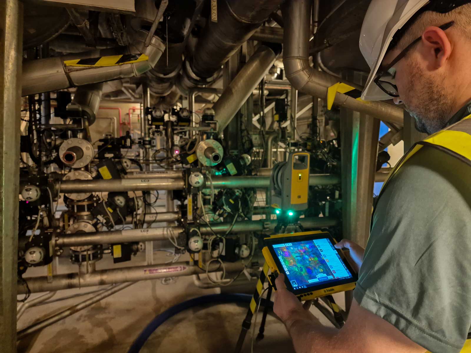
The survey is carried out station by station with a Trimble X7 scanner, without contact with the equipment. Each station captures part of the geometry and must overlap its neighbours sufficiently to allow them to be registered together.
Useful accuracy does not reduce to the nominal performance of the instrument. It depends on the network of stations, on their overlap, on the length of the traverses, on the registration method, on the tie to the site grid, and on the density of obstacles.
A registration error can propagate through the consolidated cloud. An occluded area, by contrast, contains no measurement at all. These two situations are different and must both be documented: the first affects the consistency of the geometry acquired; the second defines a limit of coverage.
We clean stray points and flag shadow zones. Where the intended use requires it, these are reduced by additional stations, covered during a later visit, or retained as explicit limits. Announcing a single accuracy figure without stating the scope, the registration and the coverage would give a misleading assurance.
The scanner measures the visible outer surface. It does not establish remaining wall thickness, corrosion under insulation, the internal condition of equipment, or the contents of an occluded area. On an insulated line it measures the outer skin of the lagging; it does not on its own allow the real diameter or the thickness applied to be deduced.
Nor does it reliably identify the material, the class, the pressure rating, the fluid or the function of an instrument. That data comes from markings, nameplates, available documents, contact measurements and discussion with the site teams.
A Reality Baseline therefore distinguishes observed data, documentary data, validated correspondences and points still to be confirmed. It does not turn an absence of evidence into a certain attribute.
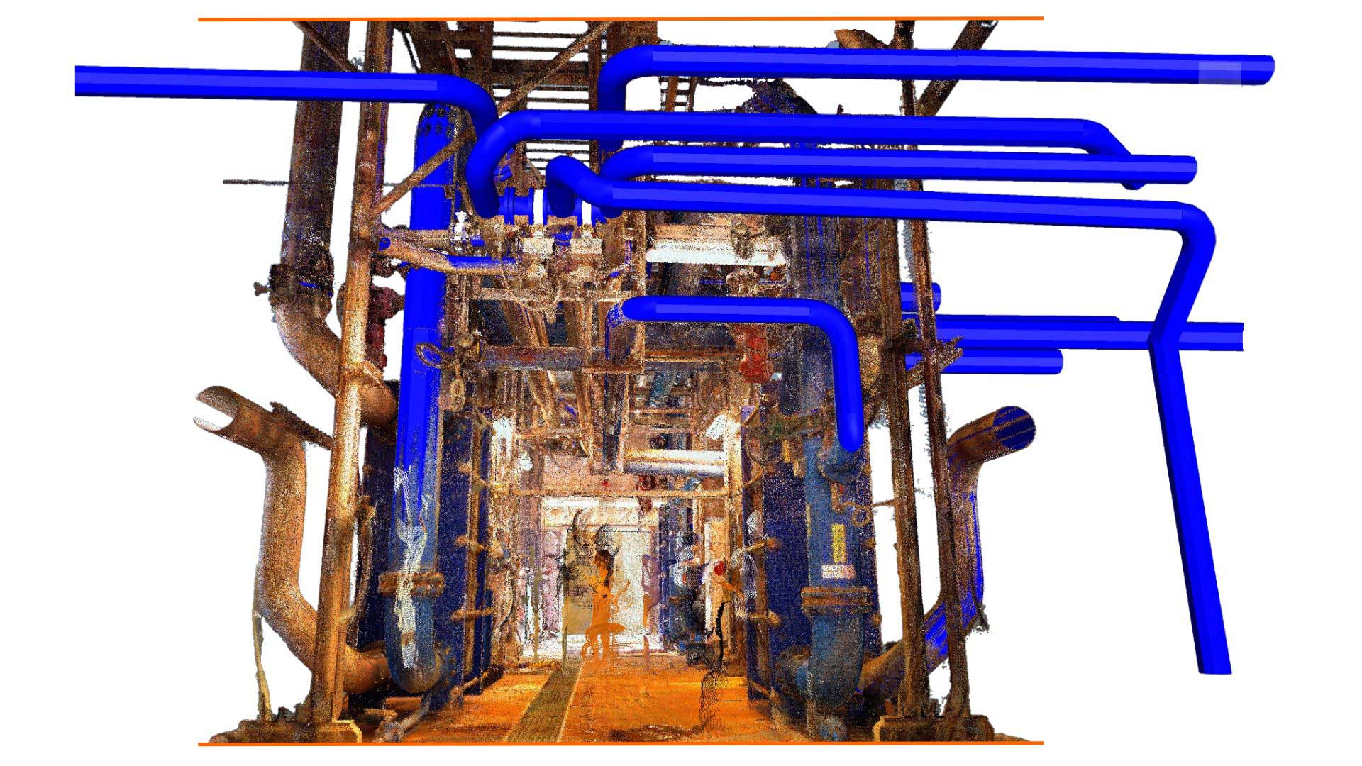
The registered stations form a single cloud, delivered in the open E57 format. That file preserves the measurement and remains usable independently of the software or the contractor used afterwards.
As-built modelling is carried out to the level of detail required by the intended use. For a piping design we do not merely reproduce volumes. We structure the lines, equipment, valves and supports with the attributes available and qualified.
The model is developed in AutoCAD Plant 3D and can be checked in Navisworks. The 2D drawings, sections, isometrics and bills of materials included in the scope are produced from the coordinated baseline, so as to reduce divergence between deliverables.
Updating a P&ID does not consist of moving symbols until the document resembles the field. Each divergence has to be qualified: equipment absent, a different valve, an inconsistent diameter, a mixed class, an instrument not found, or an ambiguous line number.
Our checks regularly meet declared pressures that are not applicable to the class retained, as well as instrumentation inconsistencies between diagram and model. These points require an engineering arbitration; an automatic graphical correction would not be sufficient.
The result therefore comprises the updated document and the associated register of discrepancies and decisions. The client knows what was observed, what was corrected, what was validated and what remains open.
The cloud and the documents can be organised in SAMP.AI to form an Industrial Shared Reality. Teams navigate the 3D environment, search for an item of equipment, take a measurement, consult the associated P&ID and reach the context available around an asset.
This shared layer aims to reduce scattered searches and repeated site visits. It helps project, engineering, construction, maintenance and production teams to speak about the same object in the same context.
SAMP does not replace AutoCAD Plant 3D for design, nor the CMMS, EDMS, ERP or SCADA as master systems. It links the visual reality, the diagrams and the useful references. Moreau Engineering can steer that continuity, within a scope validated beforehand, because we command both the survey, the structure of the piping data and its use in the design.
One point matters here: SAMP.AI is a third-party platform, distinct from our own internal tools. It is governed by its own hosting and data-processing terms, which we review with you at the scoping stage before a single document is placed in it. Using it is a project option, never a requirement.
The surveys analysed have made it possible to build a line register covering nine projects and twenty-three distinct piping classes. Such a register does not serve only the project that created it. It provides a basis for subsequent modifications, consistency analyses, tendering, maintenance and shutdown preparation.
To preserve that value, the handover has to provide open formats, stable identifiers, controlled revisions and comprehensible links between the field, the P&ID, the model and the fabrication documents. A delivery made of unstructured files quickly recreates the original problem.
Our approach therefore extends into four building blocks: Reality Baseline to establish the existing plant, Brownfield Engineering to design the modification, Digital Handover to hand over a usable dossier, and Asset Continuity to maintain the useful links beyond the project.
MEIA — Moreau Engineering Intelligence Assistant — is the control layer developed by Moreau Engineering to monitor design processes. It continuously compares the real state of a project against its reference: expected information, open decisions, scope, deliverables, milestones and dependencies.
This artificial intelligence is developed and run on an internal Moreau Engineering server, with no communication with AI services, cloud platforms or external APIs. Each client's documents and identifiable data remain isolated within their project scope. MEIA builds on the methods, engineering rules and consolidated experience accumulated by Moreau Engineering over more than twenty years — never on one client's data to serve another.
This holds for what MEIA processes: the documents submitted to it stay within Moreau Engineering's internal computing environment. It does not extend to the third-party platforms a project may call upon, whose terms are reviewed separately. The detail of what MEIA monitors and how it raises alerts is developed on the page devoted to outsourced engineering.
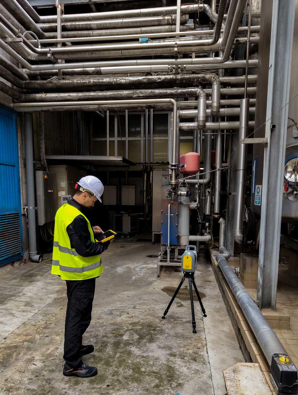
Where a site has been acquired, or where several campaigns of works never led to a complete handover, the absence of up-to-date drawings does not prevent a usable baseline from being rebuilt.
We gather the residual documents, even out of date, then survey the priority areas and interfaces. Inspection supplies what geometry cannot. Divergences are recorded and put to the holders of the information: operations, maintenance, process, inspection or HSE according to their nature.
The result is not presented as a perfect reconstitution of what cannot be observed. It distinguishes verified data, data taken from a document, assumptions, and areas not covered. That transparency is what gives the documentary record its operational value.
Depending on the scope, delivery may comprise the E57 cloud, a virtual tour, the as-built Plant 3D model, layout drawings and sections, the revalidated P&IDs, the line and discrepancy register, and the isometrics and bills of materials produced by the design work.
The level of modelling, the attributes expected, the site grid, the formats, the naming conventions and the validation responsibilities are defined before the campaign. That preparation avoids discovering after acquisition that the data collected does not answer the intended use.
Send us the objective of the survey, the area concerned, the drawings or P&IDs available even if out of date, the site grid, the access constraints and the intended use of the data: revamping study, documentary reconstitution, tendering, shutdown preparation or asset continuity. We return a proposed scope stating the areas and interfaces to be surveyed, the inspection work needed alongside, the deliverables, the limits of coverage, and the way the survey can be extended into a design or a usable Reality Baseline.
Frequently asked questions about the survey and the data
Can the scan be limited to a project area?
Yes. Scope is built around the intended use. For a modification it covers the design area and the interfaces needed for connections, supports, erection and maintenance. For a records recovery it can be organised unit by unit and extended progressively.
Can the point cloud be modified?
The cloud is the reference measurement. It can be cleaned, segmented or tied to a grid, but it must not be confused with the interpreted model. The future modification is designed in the engineering model, then checked against the cloud, which represents the state as surveyed.
What is the difference between a virtual tour and a 3D model?
The virtual tour lets you navigate the panoramas, find your way around an environment and take certain measurements. The 3D model structures the objects needed for CAD and engineering use. Both derive from the survey, but they answer different needs and carry different levels of interpretation.
How is the baseline maintained after a further modification?
The handover process must require the documents and attributes affected by the works to be revised. Depending on the extent of the modification, a targeted survey can confirm the as-built state. The new information is then integrated with its revision and its date, so that the baseline keeps a comprehensible reference state.
Do the site's existing tools have to be replaced?
No. The approach builds on the client's ecosystem. SAMP provides a context and sharing layer; Plant 3D remains the design tool; the documentary and operational systems remain masters of their data. The aim is to create useful links between these environments, not to impose a parallel database without governance.
Method and sources
The proportions quoted on this page come from the internal analysis Moreau Engineering carries out on its own projects. They cover eleven industrial installations examined through repeated audit campaigns, and all surveys analysed for the severity of findings. Extracted on 19 August 2026: since the measurement is ongoing, these values are dated. We publish only aggregates covering five surveys or more, and never a figure traceable to an identifiable installation.
Written by Moreau Engineering, a piping and process design office based in Timișoara since 2005. Last reviewed: 19 August 2026. Our confidentiality commitments are set out on the Security and confidentiality page.
Read more


